Category: Environment

For blogs that talk about Environment

  • Houston is Hot

    Houston is Hot

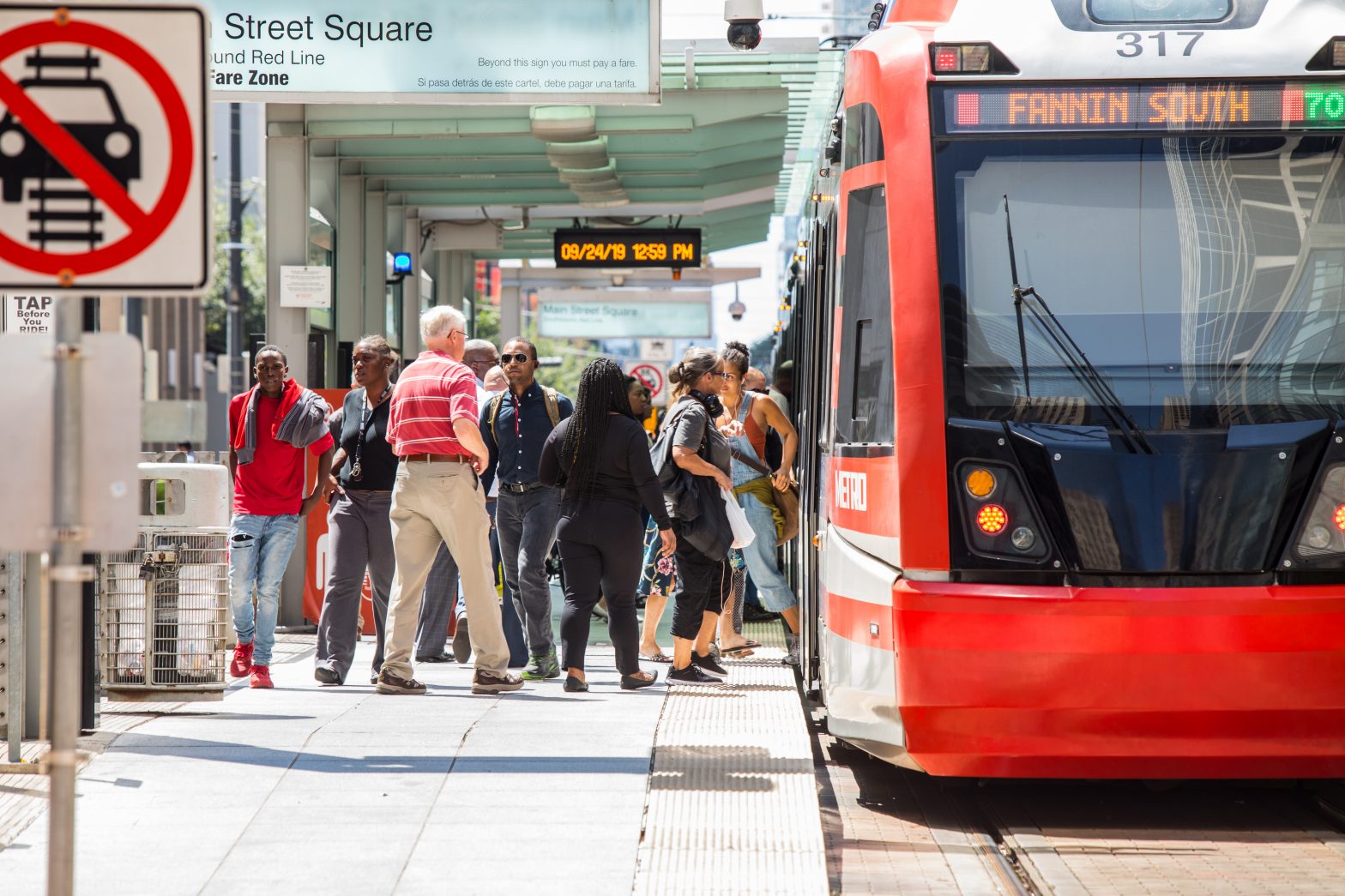
    Residents of the three-county region are no strangers to Houston’s heat

    We all know that Houston is hot. How quickly is Houston getting hotter and why? And what — aside from making us sweat — are the implications of the region’s excessive heat? 

    The rising heat foreshadows many distressing possibilities as it relates to climate change, as well as less obvious public health and economic impacts. Extreme heat in particular already kills more Americans every year than any other weather-related disaster. 

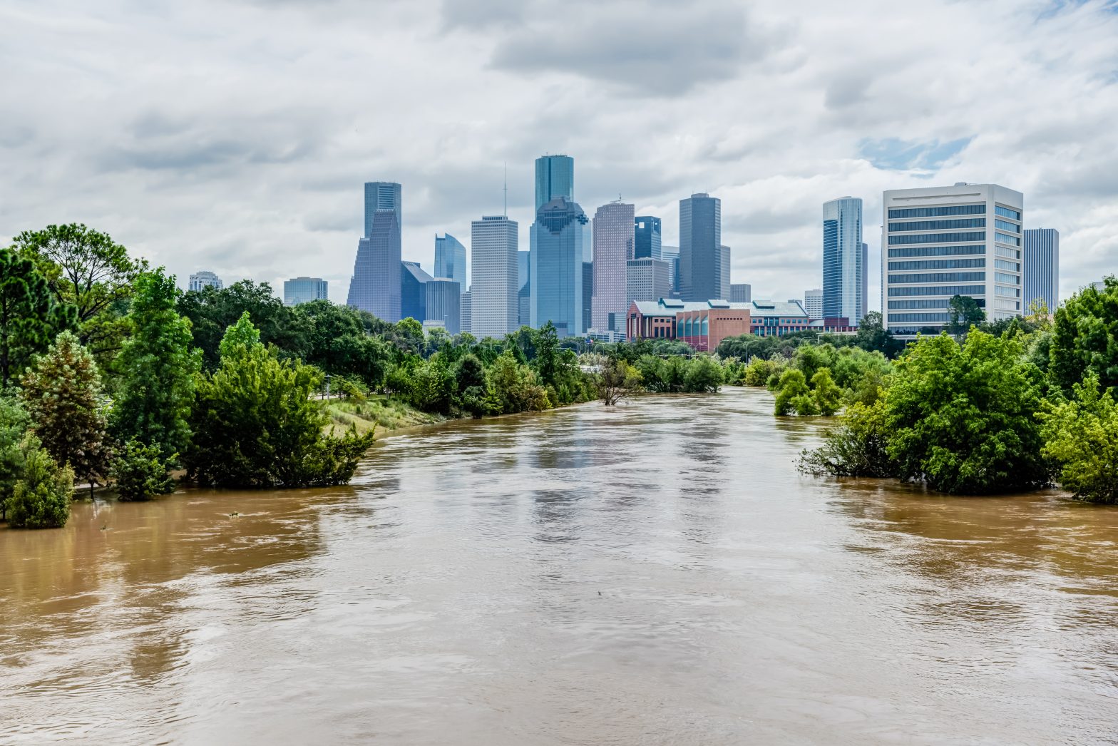
    With eight federally declared disasters in the last decade alone, a deadly winter storm in 2021, and consecutive record-setting summers, many of us feel we are already living with extreme weather. The region is currently experiencing its most severe early summer drought conditions in nearly a decade, and Houston is coming off of the hottest June in its history. The data surrounding the rising heat and the populations most affected by it can tell us a little more about both why Houston is hot and why it matters.

    How hot is “hotter,” exactly?

    Members of the Houston population who have been here a while are acclimated to Houston’s summer heat as much as one can be, although the prospect of it getting hotter surely isn’t welcomed by anyone. To answer the important qualifier of how Houston is getting hotter, we look to climate normals. 

    Climate normals, provided by the National Oceanic and Atmospheric Administration (or NOAA), are 30-year averages for climate and weather variations like temperature and precipitation. Because of the 30-year period over which they are recorded, climate normals provide a more clear picture of how our weather changes than annual variances do.

    The Climate Normals published by NOAA in May 2021 (with data representing 1991–2020) show that, compared to the previous 30-year average (1981–2010), average temperatures in the Houston region went up by between 0.6 to 1.0 degrees Fahrenheit, and annual rainfall increased by around two inches. 

    The region has already experienced a significant uptick in the number of days of extreme heat, which is defined by the CDC as days with temperatures of 95 degrees Fahrenheit or hotter. In fact, Montgomery County experienced 231 more days of extreme heat in the 2010s than it did in the previous decade — that is almost two-thirds of a year of added extreme heat over the last decade. Additionally, Harris County saw the number of days of extreme heat almost double over the same period, from 233 to 436.

    Continue reading about disaster risks and climate change in Houston

    Montgomery County experienced 231 more days of extreme heat in the 2010s than it did in the previous decade.

    How hot could Houston’s weather get?

    According to data from the Office of the Texas State Climatologist, the projected average temperature in Texas in the year 2036 is 1.8 degrees Fahrenheit warmer than the 1991–2020 average, and 3.0 degrees Fahrenheit warmer than the 1950–1999 average. They also project that the number of days in which temperatures reach 100 degrees Fahrenheit in the year 2036, will be nearly double the average rate for 2001–2020 in concentrated urban areas.

    Long-term projections predict a story of longer summers, longer Houston heat waves and less rainfall. While, according to the Resilience Science Information Network (RESIN), average annual precipitation amounts are not projected to change significantly, the season in which the precipitation occurs is. Essentially, when it does rain, it is expected to be more intense, but there is also the possibility of longer droughts. It is important to note that although the number of hurricanes the region will face is not expected to rise, the strength of the hurricanes that do make landfall is. RESIN warns that a decline in rainfall, combined with extended summers and heatwaves, could have a serious impact on social vulnerability, critical infrastructure and natural habitats.

    Projecting what Houston weather could look like in the future can be tricky, and doubt has been cast about the ability of climate models to accurately predict changes in temperature and precipitation. Research tells us, however, that climate projections tend to be pretty accurate. For example, a 2020 NASA study compared 17 climate model projections of average global temperature that were developed between 1970 and 2007 with actual changes in global temperature. Ten of the 17 models were spot on while the other seven were off by about 0.1 degree Celsius per decade. The researchers found that there was no evidence that these climate models have historically over or underestimated the impact of rising temperatures. Given today’s advanced technology and climate models, researchers express confidence that current scientists are skillfully predicting the impact of global warming.

    The Houston heat impacts some more than others

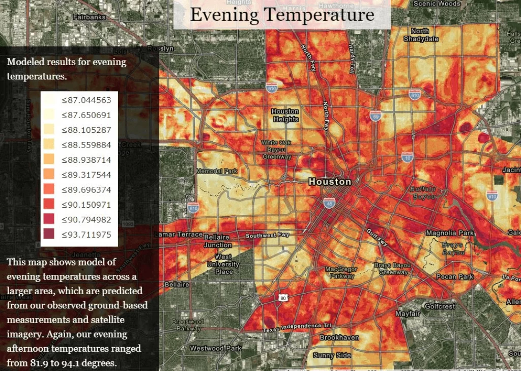
    Houston’s heat doesn’t affect everyone equally. Temperatures often vary by neighborhoods within the same city, where built infrastructure like bridges, parking lots and buildings contribute to pockets of heat known as “heat islands.” Heat islands are most likely to occur in urban areas, where there is too much concrete and too few trees to alleviate the heat. Concrete and pavement retain heat during the day and radiates it back throughout the evening, which keeps the surrounding area hotter for longer. We can feel the difference between walking across a vast parking lot on a steamy July afternoon compared to walking down a street with trees that meet in the middle.

    Houston ranks fourth in the nation in urban heat island intensity, and low-income communities and communities of color are most likely to have high nighttime temperatures in Houston.

    Heat islands are the greatest driver of heat-related health issues according to Houston Harris Heat Action Team. These heat islands can result in daytime temperatures in urban areas 1–7 degrees Fahrenheit higher than temperatures in outlying areas, and nighttime temperatures 2–5 degrees higher.

    Houston Harris Heat Action Team Heat Islands
    Source: Houston Harris Heat Action Team

    According to the World Health Organization (WHO), temperature extremes can worsen chronic cardiovascular, respiratory and diabetes-related conditions, and even small changes in seasonal average temperatures are associated with increases in illnesses and death. Extreme heat already kills more Americans every year than any other weather-related disaster, and WHO reports that extreme heat events are only increasing in frequency, duration and magnitude.

    Extreme weather may hurt our economy

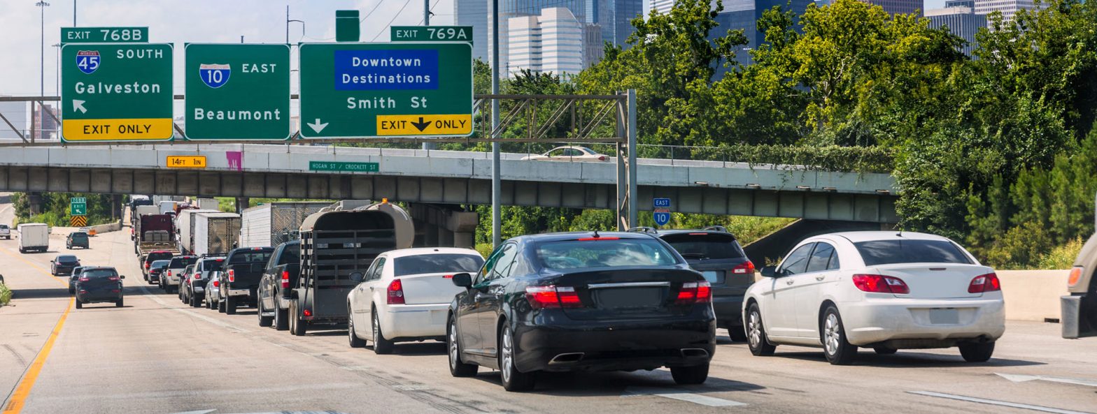
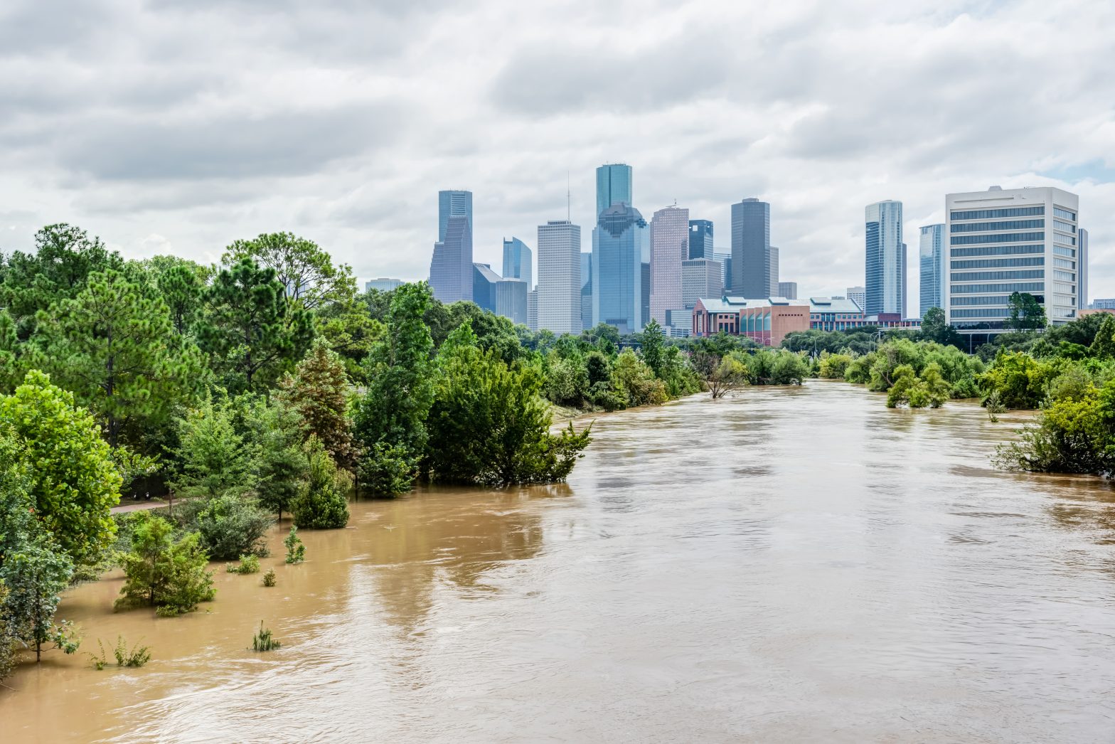
    The greater Houston region has already witnessed how extreme weather can affect our local economy. In 2017, when Hurricane Harvey inundated our region over several days, nearly all businesses were forced to shut down for a period of time because it was simply impossible to get anywhere. Much of the storm’s cost, estimated at $125 billion, is attributed to interruptions in business and employee displacement. 

    More recently, when Winter Storm Uri surprised the region in February 2021, power outages were rampant throughout the state and burst pipes damaged thousands of businesses and homes. These impacts to the Houston economy are estimated at $130 billion

    Globally, researchers estimate that rising temperatures could reduce crop yields by 30–46% before the end of the century under the slowest (B1) climate warming scenario and 63–82% under the most rapid (A1B) scenario, which would threaten our global food supply. It isn’t just national crops and higher electricity bills; extreme weather puts incalculable stress on local communities.

    In Houston, heat isn’t going away 

    Houstonians are already enduring the effects of excessive heat, but those risk factors will only become more acute as climate change continues to affect the region, and our region’s most vulnerable residents will bear the brunt of the harm. 

    How do you deal with heat in Houston? A few reminders as we get through the hottest time of the year:

    Houston is getting hotter, and we should prepare for heat and for a future of weather extremes that could repeatedly test the fabric of our region. Our continued ability to grow and prosper may depend on it.

    Helpful Articles by Understanding Houston:

  • Examining Houston’s Reputation as a Car City

    Examining Houston’s Reputation as a Car City

    A data-driven look at personal vehicle use in Greater Houston

    You’ve probably heard it from visiting relatives who just can’t seem to wrap their heads around how big the city is, asking “is this still Houston?” on the twenty-minute drive to your favorite dinner spot. Houston’s size contributes to its character, but it also makes owning and driving a car a fact of life for most residents.

    Do you need a car in Houston? It depends on who you ask and where you live. Historically speaking, Houston is similar to most U.S cities developed post World War II. As people’s ability to make and save money grew, so too did demand for things like spacious homes and personal vehicles, the latter made affordable by the innovations of the Ford assembly line. 

    But why is Houston so car-dependent today? The sheer amount of ground to cover is certainly a contributing factor to Houston’s car-centrism, but more philosophical barriers, like Texans’ fierce attitude toward independence, contribute as well. Cars offer freedom and flexibility, all while contributing to personal style and status.

    That said, Houston’s reputation as a car city, while grounded both culturally and statistically, is not immutable. In fact, 58.8% of Houstonians believe that a much-improved mass transit system is vital to the success of the city, according to the 2020 Kinder Houston Area Survey, despite the fact that 80% of Houstonians drive to work alone in a personal vehicle (2019 American Community Survey). However, research has shown that people often choose to commute by car, even when other travel modes like public transportation, walking or biking might save them time and money, making any major shifts in how people choose to get around a foreseeable challenge. 

    The cost of Houston’s car dependency

    Average commute times in Houston

    How bad is Houston traffic? It may not surprise you to hear that average commute times in Houston’s three county region are higher than the national average, or that they’re generally getting worse. Houston ranks #3 of 15 large metros for worst commuter congestion, and #4 for worst commercial truck congestion. Motorists spent an average of 49 hours stuck in Houston traffic in 2020, averaging out to $1,097 in fuel and lost time.

    According to census data, Houstonians spend an hour a day getting to and from work, which is higher than both the state and national average, according to Census data. This is all despite 80% of the population in Houston choosing the supposed convenience of driving alone in a personal vehicle. More cars on the road means more traffic. It also means more accidents, which also means more traffic. While the pandemic may have given commuters and the environment a short reprieve from congestion and pollution, both accident and roadway fatality reports show that the sojourn is over; from January to September of 2021 Texas roadways saw a 15% jump in crash frequency.

    As normalcy ebbs its way back into our lives and our roadways, so do the safety concerns, environmental concerns, and tedium that come with all those people just trying to get somewhere.

    Pollution

    Ozone pollution in Houston has abated over the last twenty years, with fewer days in which ozone poses a measurable threat to our residents. Days still exist in which just walking around in urban areas would pose significant risks to your health, often in the dead heat of summer. Despite a national decline, ozone pollution is still very much a threat in Houston, due in part to the number of cars on the road. About 60% of Houston’s ozone pollution is estimated to result from vehicle exhaust alone.

    Particle pollution (or PM) are small solid and liquid particles, like soot, released into the air by a variety of industrial processes, that reduce visibility and cause haze. Of particular concern are PM2.5 particles less than 2.5 micrometers in diameter that are easily inhaled. In 2019 the EPA determined that short or long-term exposure to PM2.5 can lead to cardiovascular disease, respiratory disease, and even early death. PM2.5 levels in Metropolitan Houston (10.1 µg/m3) are about as far below national limits (12 µg/m3) as they are above the national average (8 µg/m3). 

    National standards for acceptable levels of both ozone and particle pollution have seen consistent reductions over the years as we develop a better understanding of the danger posed by these environmental hazards. Because of this, Houston is now within acceptable limits on both ozone and PM, but has lagged behind the national pace of reduction in both categories. The air quality in Houston is still of great concern, as the American Lung Association State of the Air Report rates the air in Harris and Montgomery counties an “F,” and the PM2.5 numbers could fall on the wrong side of the new national limit upon the EPA’s imminent reexamination.

    So if we’re doing better, and Houston falls within most national guidelines, why is this important? Because pollution doesn’t affect everyone in the same way — some neighborhoods face higher threats than others, and Black and Hispanic residents most acutely suffer the effects of pollution though they produce less of it.

    Continue reading about Houston’s climate at UnderstandingHouston.org

    Houston’s car-centric infrastructure

    Given the consequences of high solo-commuting rates, why don’t more residents elect to ride Houston’s public transportation? Is Houston walkable? Bikeable?

    Simply put, most of the region is just not very walkable. According to the National Walkability Index provided by the EPA, most neighborhoods in all three counties have below-average walkability. This car-centric infrastructure is due in part to the sprawling geography of Houston, but also has a lot to do with the cultural prioritization of cars over pedestrians. Houstonians want walkable urban spaces, but the cultural and infrastructural barriers are high and made of poured concrete.

    Cyclists face similar issues in that the city is built to serve motorists. Biking carries the same (if not more) health and environmental benefits as walking. Houston can be a delightful place to bike after all; the city has committed to the creation of 1,800 miles of bike lanes by 2027 through its Bike Plan. Although 345 of those miles currently exist, only 25 miles are protected (just over 7%), a fact that underscores why many might be reluctant to pick up the hobby.

    However, cycling is not always a hobby. Many bike commuters choose to cycle not out of respect for its social or cardiovascular benefits, but out of necessity; your average bicycle costs a lot less than a car. And due to Houston’s car-centric streets, bicyclists often endanger themselves getting around, with Harris County drivers striking cyclists 557 times in 2021, killing 23 riders. 

    What about Houston’s public transportation? Why is it that Houstonians choose public transit at half of the national rate?

    Although national rates for commuters choosing public transportation have gone up since 2010, rates in Houston, and Texas at large, have actually gone down. Part of the problem is the availability of stops in general. Only 5% of households in Fort Bend and Montgomery counties are located within a quarter-mile of a public transit stop, while Harris County sits at 38%.

    Low-income populations use public transit far more often than others, a finding consistent with national trends. In 2017, more than twice as many Harris County residents in poverty used public transportation as those who live above the poverty line.

    These individuals would benefit from more bus and train stops as first steps, in addition to basic amenities (such as benches or roofs), extended service hours, and expanded routes to fully access the vibrant culture, prosperity and opportunity Greater Houston has to offer.

    The road ahead

    Steps have been taken to make our region less car-reliant and safer for those who do choose to ride bicycles or public transportation when traversing the region. Where there once were no protected bike lanes in the city of Houston, there are now 345 miles of high-comfort bike lanes, with plans for 1,800 more miles currently in progress. Additionally, programs like Houston BCycle are making it easier for residents of all means and backgrounds to choose bikes over cars when traveling within urban areas.

    Houston-area cyclists aren’t the only ones enjoying improvements to our transportation infrastructure; thanks to people like Janis Scott and the team at LINK Houston, safe and comfortable public transit options are reaching more parts of our region than ever before.

    When armed with the right information, we believe our region can continue to take the steps necessary for a less congested, more free-moving Houston that’s safe and accessible for all.

    Helpful Articles by Understanding Houston:

  • How community gardens support the fight against food insecurity in Greater Houston

    How community gardens support the fight against food insecurity in Greater Houston

    Houston ranks among the top 50 cities with the highest obesity rates in the U.S., with 34% of Houston children now struggling with obesity. At the same time, Feeding America reports that Harris County has the second-highest number of food insecure individuals across all US counties, with 869,000 individuals not knowing when or where their next meal is coming from.

    The single largest predictor of an individual’s health is the community in which they live. People who live in low-income areas with low access to fresh food struggle to secure nutritious options and are more likely to suffer from disproportionately high rates of obesity and diet-related diseases. Today, children in low-income communities are more likely to confront an obesity epidemic — one that afflicts 13.9% of low-income children in the nation, and many lack access to safe, outdoor spaces to congregate and play

    How COVID-19 exacerbates food insecurity in Houston

    COVID-19 has exacerbated existing food insecurity, disproportionately affecting low- and moderate-income households, while also introducing food insecurity to individuals who had never before experienced barriers to food access.

    Food insecurity in the region peaked in November 2020 with nearly 30% of Houston-area households with children reported experiencing food insecurity. Though that rate has fallen to 22% as of March 1, 2021, some communities still feel the burden at disproportionately high rates. One-third of Black households with children and 25% of Hispanic households with children report continued food insecurity, compared to 11% of white households with children. Changing health landscapes and heightened food insecurity have demonstrated a surging need for inclusive, community-driven food interventions.

    Understanding the challenges facing community gardens in Houston

    Urban Harvest leads holistic interventions that combine neighborhood revitalization, community development, healthy food production, preservation of greenspace, and ecological stewardship that contributes to biodiversity. Community gardens provide affordable and accessible healthy foods in low-income neighborhoods with limited access to fresh foods.

    Since 2018, Urban Harvest has transitioned from building gardens to sustaining gardens in response to the needs of the gardens we serve. We set out to identify how we can better support community gardens to be more sustainable. Working with the 140 affiliate gardens in our network, we discovered five key elements that well-established, successful gardens share: they meet monthly as a group; they develop a clear leadership team that makes decisions for the garden; they inform gardeners of what goes on day to day; they build a large base of active gardens; and, they offer consistent events and programming.

    However, our deep-dive also revealed disparities within our affiliate garden network. We learned that gardens in under-resourced (socially vulnerable and/or low-income, low-access) communities experience heightened challenges to becoming sustainable. Importantly, gardens in under-resourced communities make-up a significant part of the network: 54%, or 73 distinct sites.

    These disparities have been heightened by COVID-19 and the recent winter storm. Key findings from our recent COVID-19 needs assessment revealed that due to the pandemic, under-resourced gardens have too few gardeners, and rate their volunteer needs a 5.8 on a scale of 1 (lowest need) to 6 (highest need). Even higher-resourced gardens rated their volunteer needs 4.5. Other top needs among under-resourced gardeners include compost, fertilizer and mulch. And, finally, almost 30% of surveyed gardens reported that their gardens have become less well-established.

    Community gardens help under-resourced Houston-area neighborhoods

    Community gardens are assets for any neighborhood, but represent unique opportunities in otherwise under-resourced communities in particular. Successful gardens can build community power through placemaking of safe, outdoor spaces; creating opportunities to connect with neighbors and community members from different backgrounds; preserving greenspace; and offering affordable, healthy food. In 2020 alone, our community gardens resulted in 225,000 pounds of produce (resulting in about 190,000 meals), of which 136,000 pounds were donated, and our gardens served more than 260 customers through Mobile Markets. But, as we have seen, community gardens depend on the community to survive and thrive, particularly in times of disaster. The results combat food insecurity, offer opportunities for physical activity, and promote resident health.

  • Four Facts Every Resident Should know about Houston’s environment

    Four Facts Every Resident Should know about Houston’s environment


    Greater Houston has many reputations, many good, some more challenging. We’re the Space City, Clutch City and home to the medical capital of the world. We’re also known to be the Bayou City, the Energy Capital of the World and a car city, to name a few. On their own each reputation speaks to a different facet of our region. But when viewed collectively, they have broader, more troubling implications for our region’s health. 

    Over the past several decades, population growth and urban development have contributed to historic economic expansion throughout Greater Houston’s three-county area. This expansion has led to new job opportunities, expanded access to vital resources and created new community spaces for recreation. It has also had considerable consequences for our natural environment, including impacts on our region’s natural resources as well as water and air quality in Houston. And, for residents of Houston, climate change is already a reality that carries additional implications for our region as we continue to face extreme weather in the future.

    The preservation of Greater Houston’s natural environment is crucial to the ongoing health of our region and its residents. Though there are many factors influencing Houston’s environment, these broader trends are an important first step in understanding where our region stands and, ultimately, working to protect it moving forward. 

    1) Greater Houston emits about 68 million metric tons of industrial greenhouse gas emissions

    According to a 2019 report by the EPA, energy production and consumption account for 61.2% of greenhouse gas emissions in the U.S., and as the “energy capital of the world,” Houston plays a significant role in creating and managing harmful greenhouse gases.

    Greenhouse gases (e.g., carbon dioxide, methane and nitrous oxide) trap heat in the earth’s atmosphere, contributing to global warming and climate change both in our region and around the world. Greenhouse gas emissions are on the rise in the region, even with the COVID-19 pandemic temporarily reducing Houston traffic and energy use. 

    Between 2011 and 2017, total greenhouse gas emissions generated by industrial facilities in the three-county region fell 3%, according to the Environmental Protection Agency (EPA). Non-biogenic carbon dioxide (C0) emissions (derived from fossil fuels) fell by 3% and biogenic C02 fell 40% while methane and nitrous oxide emissions increased by 6% and 2%, respectively. Since 2017, total greenhouse gas emissions have ticked back up 2%. While non-biogenic C02 has remained flat between 2017 and 2019, methane emissions have increased 22% in the last two years and biogenic C02 fell 44%, according to the EPA.   

    Read more about Houston’s air quality and the City of Houston Climate Action Plan

    2) Our region is increasingly reliant on cars

    Greenhouse gas emissions generated by industrial facilities are only part of the equation. Automobiles contribute to 28.9% of human-generated greenhouse gas emissions in the country, and Greater Houston is a very car-reliant region. Between 2010 and 2017, the percentage of Houston-area households that own at least one car grew one percentage point to 94.7%. This is higher than the national rate of 91.4%, which grew by only 0.5 percentage points over the same time period. Further, Houston-area residents are purchasing more vehicles at a faster pace than the nation overall, and they’re spending more time in them.

    Between 2010 and 2017, the percentage of households with three or more vehicles in the three-county area grew by 38% — more than double the 15% national growth rate. All these cars on the road contribute to higher than average commute times, with 13.3% of three-county residents reporting 60-90+ minute daily commutes.. 

    This disparity isn’t simply a matter of Houstonians preferring to drive or not caring about Houston’s environment — for most residents, public transit and/or walking simply aren’t practical options. 

    In both Fort Bend County and Montgomery County — where residents face above average commute times — fewer than 5% of households live within ¼ mile of a public transit stop. While Harris County fares better thanks in part to continued efforts by METRO, most households in the area are still out of walking distance from a public transit stop. As a result, only 2.3% of Houston-area workers commute on public transit — less than half the national rate.

    As most residents know, in general, walkability is not one of the Houston area’s strong suits. 

    On average, Montgomery County has fewer than 0.6 linear miles of connected sidewalk per square mile of land. While Fort Bend County and Harris County are more walkable with 4.4 miles and 7.6 miles of connected sidewalk per square mile of land, respectively, it’s clear that making Greater Houston more walkable needs to remain a priority of our region’s ongoing growth strategy. 

    3) Wetlands and farmland shrink as developed land increases

    It’s no secret that Greater Houston is growing, and with that growth comes a shift in how we use our region’s natural resources. In recent years, our region’s land cover has shifted heavily in favor of developed land, which makes up more than 1,800 square miles of our region. 

    Between 2001 and 2018, the percentage of developed land grew by 18–19% in all three counties, accompanied by some other striking changes throughout the region. In Fort Bend County, farmland decreased from 59% of total land cover in 2001 to 15% by 2018. In Harris County, forest and wetland continued to lose already low shares of land cover — as they did throughout the region — dropping to 10% and and 4%, respectively.  Also noteworthy is the increase in pasture/grassland throughout the three-county region. Viewed alongside the region-wide decrease in farmland coverage, this transition may portend even more increases in developed land in the future, as new grassland often preempts additional development on a previously wooded area. 

    Further Reading: Take a closer look at the state of our region’s water supply →

    Of particular concern is the decline in wetland coverage seen throughout the region. The low-and-declining levels of wetland coverage throughout the three-county area in the absence of resilience measures to compensate come with increased risk of flooding in Houston, from heavy rainfall in urban areas — a growing concern for our region today and in the future.

    4) The effects of continued climate change pose distinct challenges for Greater Houston

    Extreme precipitation is a problem with which many Houston residents are all too familiar. In the last five years, Houstonians endured four extreme precipitation events that were declared federal disasters, the most costly of which, Hurricane Harvey, dropped more than 60 inches of rain and caused more than $100 billion in damages. If climate change continues at its projected pace, Greater Houston will need to prepare for even more extreme precipitation events. 

    Over the next 50-60 years, the number of extreme precipitation days is expected to increase from 11.3 in 2020 to 11.6 by 2080. While this increase may seem slight, it’s important to consider the damages our region sustains from these extreme precipitation events, especially when 58% of residents in the region currently live in a census tract with increased vulnerability to the effects of natural disasters in Houston — many of them low-income and/or Black or Hispanic.

    As familiar as Houstonians are with extreme rain, we are even more familiar with the intense Houston heat. If climate change trends continue at their current pace, we may need to brace ourselves for even more higher temperatures than we already endure. 

    Between 2020 and 2050, the number of extreme heat days with temperatures over 95 degrees in the three-county area is projected to grow by as much as 47% to 51% over the next 30 years, with Fort Bend County seeing the most frequent extreme heat days in the region, a deeply problematic projection that has worrisome implications for resident health and energy use throughout the region. 

    Understanding Houston’s environment is the first step toward meaningful action

    We may not be able to control the weather or the implications of Houston’s population growth, but that doesn’t mean we are powerless in the fight against climate change or in making our region more sustainable and resilient for all who call it home. By taking the time to understand the data, we are one step closer to taking the targeted action that truly matters in our communities, which helps ensure a brighter future for all.

    As a community-driven nonprofit, our mission to connect community leaders (like those at Houston environmental organizations) with the data they need to make informed decisions relies on the action and generosity of people like you. Consider exploring how you can get involved with Understanding Houston, and stay tuned to our social media for new data, insights and program updates.

    Helpful Articles by Understanding Houston:

  • Janis Scott: A Powerful Voice for Fair and Accessible Transportation

    Janis Scott: A Powerful Voice for Fair and Accessible Transportation

    We would like to acknowledge and thank Janis Scott for her unceasing commitment to improving and preserving public transit access for all Houston-area residents.

    Janis Scott, LINK Houston Board Member

    A Rice University graduate and a native Houstonian, Janis has been riding the bus all her life. She knows the lines, the drivers and the riders; she also knows the board members and executives who keep them moving. And when some of those crucial lines faced cuts, Janis knew exactly where to go to help riders’ voices be heard. 

    “We want comfortable, dignified waiting areas for our buses. We should not continuously have to ask and beg and plead for basic amenities,” said Janis of Houston’s underserved public transit users. “My vision is crossing ‘boundaries,’ not feeling like I’m imposing, taking a chance on rejection. Not answering if asked what part of town I live in, and if I live in a bad neighborhood.”

    As Janis’ voice for Houston’s underserved transit users grew louder, her profile rose, eventually earning her the nickname “The Bus Lady” and a seat on the board of LINK Houston, where she fights for more fair access to public transportation

    Fewer than 5% of households in Fort Bend and Montgomery counties are located within a quarter mile of a public transit stop. In Harris County, that rate climbs to 38%. In LINK’s 2020 report, the three high-demand areas for more transit investments include east and southeast Houston, southwest Houston and the Greater Greenspoint area. These communities have higher levels of poverty and lower rates of vehicle ownership compared to the overall county. The report calls for four main recommendations: 1) Increase frequency of routes; 2) extend service hours; 3) improve reliability and on-time arrivals; and 4) pursue accessibility and other transit stop upgrades. 

    As for the nickname “Bus Lady,” Janis is proud of the reputation she’s built: “The nickname ‘Bus Lady’ started as a quick way to identify me when my name could not be quickly recalled. There have been some METRO folks who have asked for my advice on what is being done, since I tend to have a non-conformist view on what ‘everybody else’ thinks and does. Some have in fact put their phones down and relied on me to be ‘their Google’ transit app! I am honored to be a go-to source when someone is stuck, confused, and needs assistance. I’m happy to help!”

  • The State of Water Quality in Houston: Four Stats Every Resident Should Know

    The State of Water Quality in Houston: Four Stats Every Resident Should Know

    In no uncertain terms, easy and fair access to clean water is an absolute necessity for a prosperous Houston and its residents. And while many dedicated local officials and nonprofit organizations work to maintain the safety and drinkability of Houston’s water supply, some troubling trends require our region’s attention and action in order to keep our water supply healthy for all. 

    Working to protect our region’s water resources will require the awareness, input and action from people across the region — all of which starts with exploring the data. 

    1) Houston’s water supply is decreasing relative to our population growth

    As the greater Houston population grows, so too does our water usage. Though our region’s supply is currently strong, careful use and conservation will be essential to maintaining and extending our resources for future generations. 

    In Fort Bend and Harris Counties, water withdrawals increased between 2010 and 2015.

    In the three-county region’s two most populous counties — Fort Bend and Harris — water supply (also known as “withdrawals,” which refers to water taken from the ground or surface for use in homes, businesses, industries and food production) increased between 2010 and 2015 (most recent data available). Unsurprisingly, Harris County extracted the most water in 2015, withdrawing 287 milligals per day, up 2.5% from 2010. Similarly, withdrawals in Fort Bend County increased by 2.1% over the same time period, while Montgomery County withdrew less water in 2015 than in 2010. 

    The amount of publicly-supplied water per capita decreased between 2010 and 2015.

    Withdrawals supplement water collected from rain which is also used for similar purposes, so while this measure is not a comprehensive indicator of a community’s total water supply, it is an important one, particularly within the context of population. The available water supply relative to the overall population (per capita) decreased in all three counties between 2010 and 2015. The decline in availability was most severe in Harris County, where supply dropped by nearly 15% over the 5-year period. A recent report from Texas Living Waters Project found that water conservation in Houston has worsened recently, primarily as a result of water loss in its distribution system (such as from leaking pipes). More broadly, Texas2036 reports that if Texas were hit with a drought today, the state would be unable to meet one-fourth of its water needs — calling on policymakers to reduce Texas’ water shortage by 40% by 2036. 

    Read more about droughts and climate change in Houston

    2) Levels of drinking water contamination in Houston are (mostly) low

    While we need to continue to monitor our water use, the good news is that our drinking water presents low levels of contamination and is generally safe to drink. 

    Water contamination is typically tracked by measuring levels of coliform bacteria, which indicate the presence of human or animal waste. One commonly recognized coliform bacteria is E. Coli, which is often harmless but can cause serious illness depending on the strain. Water contamination is also determined by the presence of non-coliform bacteria, harmful environmental organisms and inorganic chemicals.

    A 2018 study conducted on Harris County’s water quality — the largest county in the state — found that 150 out of nearly 63,000 water samples contained a presence of coliform bacteria (0.24%). However, the presence of inorganic contaminants was noticeably higher. In the same study, 7.6% of 24,300 non-coliform samples exceeded limits for compounds possibly connected to industrial waste in the region.

    3) Most Houston-area waterways are unsafe for human exposure

    While drinking Houston tap water may be mostly safe, our natural bodies of water are another story. While large bodies of water aren’t usually the first thing people envision when they hear the name Houston, we didn’t get the nickname “The Bayou City” by accident. As home to four major bayous and more than 2,500 miles of waterways, the health of local bodies of water is an important indicator of our region’s larger environmental condition.

    Nearly 900 miles of the region’s water streams, or 60%, are contaminated and unsafe for human consumption/exposure. 

    Harris County has twice as many miles of impaired water streams as unimpaired streams.

    In Harris County, 71%, or 515 miles, of water streams are impaired, as are 52% of Montgomery County’s. While Fort Bend County has more miles of unimpaired streams than impaired streams, 43% of waterways are still unsafe. These ground or surface water streams are largely made unsafe by bacterial contamination, likely created by malfunctioning wastewater treatment plants, overflowing sewers and failing septic systems. Severe storms that cause flooding in Houston can also exacerbate Houston water contamination, particularly in areas prone to flooding.

    4) Less trash is being thrown into our waterways

    What causes water pollution in Houston? While industrial pollution and waste management practices account for much of Greater Houston’s water contamination (found in both waterways and groundwater), trash and litter from individual residents also play a role in the condition of our waterways. Fortunately, recent data suggest that littering and trash dumping in waterways is on the decline in the Houston area.

    Each year, residents across the state join hands to remove waste and debris from our waterways during the annual Trash Bash. In recent years, Trash Bash volunteers have been finding and collecting far less trash than they used to. 

    After peaking in 2001, the amount of trash collected from Houston-area waterways has drastically declined.

    In 2019, Trash Bash volunteers collected 56.5 tons of trash from Houston-area waterways, compared to 107.5 tons collected ten years prior, and 212.5 tons collected in 2001. While the Trash Bash is not a scientific study, the volume of trash collected does paint a picture of the amount of litter contaminating our waterways — and less trash collected can reasonably be interpreted as good news for the greater Houston environment.

    Protecting Houston’s water supply is a job for everyone

    When it comes to water quality in Houston, each of us can take meaningful steps to conserve and protect our region’s water for all residents throughout our region.

    From reducing wasteful consumption to participating in local cleanup efforts and reaching out to your local officials with concerns and suggestions, there are many ways we can make a difference in our community.

    Want to get involved? Check out these nonprofit organizations that do amazing work to protect our region’s water supply and see when and where you can help out:

    To keep up with the latest data on Houston’s water quality, environmental health and more, be sure to follow Understanding Houston on social media, subscribe to our newsletter and hear more from community voices

    Helpful Articles by Understanding Houston:

  • After six federal disasters in five years, why do we not fully prepare?

    After six federal disasters in five years, why do we not fully prepare?

    Fellow Houstonians, we are one month into the 2020 Atlantic Hurricane Season. Experts predict another above-average hurricane season this year — meaning we could see more storms active in the Atlantic Ocean and Gulf Coast. Indeed, the beginning of the season has already been very active.

    Houstonians have experienced the devastation and loss from six federally declared flooding disasters in the past five years, most notably Hurricane Harvey. Weather events do not have to be a national disaster to make an impact. Even one inch of water inside a home can cause $25,000 worth of damage. Flood events that were believed to occur every 50 years have been occurring annually in recent years. This is not an anomaly. Research shows the frequency and intensity of rainstorms have increased throughout the Houston area, and the number of extreme precipitation days is only projected to worsen in the coming years.

    Even one inch of water inside a home can cause $25,000 worth of damage.”

    People in general are not great about preparing for natural disasters like flooding and hurricanes. Psychologically, our minds have a hard time grappling with massive, far-off, highly uncertain things, which can result in poor decision-making if we are caught without a plan. Also, we tend to have short memories about how we felt in the throes of disaster – diminished memories reduce the sense of urgency we feel to prepare. For example, an August 2018 (one year after the historic Hurricane Harvey) online poll found that 72% of residents in Texas had not taken any precautions in advance of hurricane season and nearly two-thirds did not have an emergency bag prepared. And, given how eventful the first half of this year has been, it’s not surprising that preparing for hurricane season is not top-of-mind for most of us. But, it must be. Here’s why.

    How COVID-19 complicates natural disaster preparation 

    Imagine there is an invisible shield protecting our community from the negative effects of flooding and natural disasters. This shield is composed of layers that include a prepared, healthy, financially and economically secure populace; a well-resourced and unconstrained nonprofit sector; plentiful capacity in our hospitals and emergency management sectors; and, of course, strong feelings of trust within and connection to our community at large. All these factors contribute to a community’s resilience and recovery from a disaster, strengthening the shield. 

    But this shield can only be as strong as its weakest layer, and right now, all layers are stretching their limits. We are experiencing record unemployment. More than 800,000 families in the Houston-area were economically insecure before the pandemic, and many are struggling financially as a result of impacts from COVID-19. Nonprofits are working at maximum capacity serving those affected by COVID-19. Our hospitals are beginning to reach capacity. And we are currently fighting the worst pandemic in a century, meaning resources are strained across the board — both public and private. Complicating rescue and recovery efforts, “neighbors helping neighbors” has added risk during a time when we need to practice social distancing. Even more worrisome, social distancing will be challenging in venues like NRG or the George R. Brown Convention Center which typically serve as temporary shelters during and immediately after major storms.

    The protective shield is made stronger each time one of us takes action to improve our chances of bouncing back from a serious storm.

    That’s why it is all the more important to actually prepare this year, Houston. The protective shield is made stronger each time one of us takes action to improve our chances of bouncing back from a serious storm. This includes doing things like preparing a disaster kit, formalizing a communication plan with our loved ones, and protecting ourselves and our homes. It is imperative we do these things since there is so much that we cannot control.

    Take these steps now to prepare

    1. Get information. Visit your county’s Office of Homeland Security and Emergency Management website for excellent resources on preparing for a natural disaster, particularly during a pandemic. These sites have checklists and suggested plans for preparing disaster kits, caring for your pets, communicating with loved ones, reviewing flood zone maps, and purchasing flood insurance.
    2. Prepare a disaster kit
    3. Complete a family communication plan. Plan how you will assemble your family and loved ones, and anticipate where you will go for different situations. Get together with your family and agree on the ways to contact one another in an emergency, identify meeting locations, and make a Family Emergency Communication Plan.
    4. Assess flooding risk. Know if your home is at risk of flooding. You can view a Flood Insurance Rate Map (FIRM or floodplain map) at the Federal Emergency Management Agency’s Map Service Center or at your county emergency site.
    5. Consider purchasing flood insurance. Harris County Flood Control District recommends that all Harris County residents become informed about their flood risk and have flood insurance no matter where they reside in Harris County. Flood insurance accelerates the rebuilding and replacement of personal property and fosters community resiliency as a whole. For information on flood insurance, visit the National Flood Insurance Program website or call 1-888-379-9531.
    6. Sign up for emergency alerts. The Flood Warning System (FWS) offers an alert feature that allows residents to subscribe to and receive email/text alerts that report near real-time rainfall and water levels. Residents are able to customize alerts and notifications for bayous and tributaries in their particular areas of interest. Sign up for the Alert Notification System at fwsalerts.org.
    7. Don’t get complacent – educate yourself. Check out these other great resources.

    We may contain COVID, but storms are here to stay

    Time will tell if 2020’s COVID-complicated hurricane season will bring a storm as historic or destructive as Hurricane Harvey, but the steps we take to strengthen our shield today can also help to fortify our region for future natural disasters. After all, a lasting solution to COVID-19 may be around the corner, but flooding and hurricanes in Greater Houston are here to stay.

    If you haven’t already, get ready. Hurricane season is a six-month marathon from June 1 through November 30. Let’s do our best to fortify that protective shield for our entire community. Let’s prepare, Houston.

  • Business manager, multi-county commuter

    Business manager, multi-county commuter

    Ryan Stough: Manager — Parent — Commuter

    As a six-year Houston resident, Ryan Stough has become all too familiar with one of Houston’s biggest headaches: long commutes. 

    As a Pearland resident, Ryan’s job as a general manager at a Houston-area Mister Car Wash Lube Center requires him to commute across two counties each day. And without access to any METRO public transportation from his community, he’s forced to rely solely on his car to complete his daily commute. 

    “When we bought the house, we didn’t really think about the commute,” Stough said. “I told my wife to pick an area she liked that was close to her teaching job because my job location is never secure. One day they might have me at one location for six months and the next day I will be at another.” 

    In the past three years, Stough’s work location has moved from Humble to Kirby and US-59/I-69 to the Sugar Land area. Currently, he’s commuting from Pearland, which is in Brazoria County, to the Sugar Land location, which is in Fort Bend County. Before moving to the Sugar Land location, he was traveling into Harris County to work off of US-59/I-69 and Kirby. 

    “I leave at 5:45 a.m. and it takes about 30 to 35 minutes. If I leave a minute after 6 — and I mean a minute after 6 — then there’s a lot of traffic,” Stough said of his more than 25-mile commute to Sugar Land. “It’s a little better when teachers are on their summer break. But coming back from the Kirby location, it would take me 45 to 50 minutes.”

    Stough currently drives his Toyota Tacoma and spends about $120 per month just on gas, but he’s working on repairing his Honda Civic, which would cut his gas bill in half. His wife, Tabitha, also has a vehicle of her own. 

    Overall, Stough has come to accept his commute across two Houston-area counties as a part of his life now. “I’m pretty comfortable with the commute,” Stough said. In fact, Stough doesn’t mind his commute so much so that he’s willing to drive further for a higher paying position at the Mister Car Wash location in Humble. “I would make that sacrifice to drive further for much more money,” Stough said. 

    But he does keep in mind the cost of his time due to his commute. “I would say the only negative to my commute is the time away from my family because I already work long days and my commute is 30 minutes each way so that adds an extra hour to my workday,” he said.

    Lack of access to public transportation in many Houston-area suburbs contributes to longer commutes for many Houstonians. Visit the links below to learn more about public transportation accessibility in the region. 

    Additional Resources: